Murau
Austria
Completed
1996
– 2002
Basics
33/3
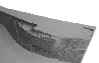
Site in 1990
Grundstück um 1990
© TWA
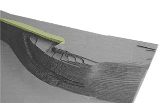
Site in 1990 with cantilevered concrete structure for (semi-bridge on the hill)
Grundstück um 1990 mit auskragender Betonkonstruktion (Hanghalbbrücke)
© TWA
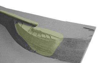
Site in 1990 with cantilevered concrete structure and man-made fill (landfill and parking lot)
Grundstück um 1990 mit auskragender Betonkonstruktion und der künstlichen Hanganschüttung (Deponie und Parkplätze)
© TWA
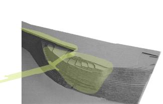
Site in 1995 with cantilevered concrete structure, the man-made fill and the new wooden pedestrian bridge, completed in 1994
Grundstück um 1994 mit auskragender Betonkonstruktion, der künstlichen Hanganschüttung, und der um 1994 fertiggestellten, hölzernen Fußgängerbrücke
© TWA
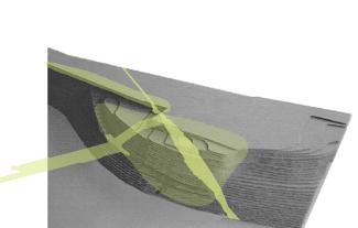
Site in 1995 with cantilevered concrete structure, the man-made fill, the pedestrian bridge completed in 1994 and the proposed incision into the volume of the man-made fill for the new municipal building
Grundstück um 1994 mit auskragender Betonkonstruktion, der künstlichen Hanganschüttung, der um 1994 fertiggestellten Fußgängerbrücke und dem für den Neubau der BH Murau vorgeschlagenen Schnitt in die künstliche Hanganschüttung
© TWA
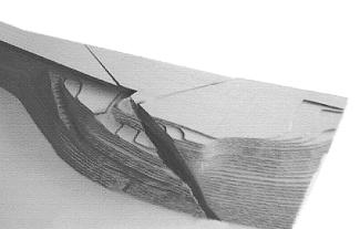
Proposed longitudinal, negative space on site
Geöffneter Schnitt im Gelände
© TWA
1/6
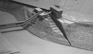
Displacement of volume: material taken along a line from the fill is piled up along the edges.
Massenverlagerung: dem Gelände, der Anschüttung also, wird Material entlang einer Linie entnommen und an den Rändern aufgehäuft.
© TWA
1/1
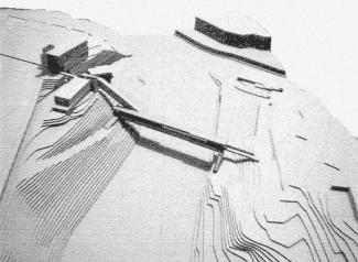
Dissected and reassembled landscape model. The buildings reflect the restructured mass displaced from the site.
Zerschnittenes und neu zusammengefügtes Landschaftsmodell. Die Bauformen bestehen aus der neuorganisierten Masse des Grundstücks.
© W. Feiersinger
1/1
Views
113/11
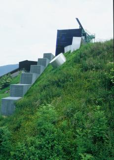
14 July 2002, 16.00: view from the banks of the Mur river
14.7.2002 - 16:00, Blick von der Uferlinie der Mur
© W. Feiersinger
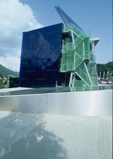
25 Aug. 2002, 12.55: west view of the structures above ground level
25.8.2002 - 12:55, Westansicht der Baukörper über Niveau.
© W. Feiersinger
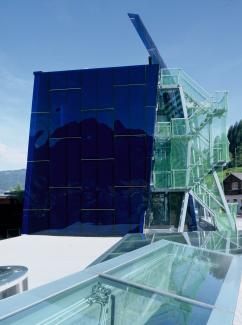
25 Aug. 2002, 14.27: west view of the structures above ground level, skylights of underground spaces
25.8.2002 - 14:27, Westansicht der Baukörper über Niveau, Oberlichten zu unterirdischen Räumen.
© W. Feiersinger
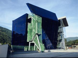
25 Aug. 2002, 17.10: west view of the structures above ground level
25.8.2002 - 17:10, Westansicht der Baukörper über Niveau
© W. Feiersinger
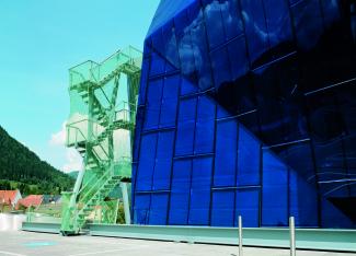
28 May 2002, 12.15: view from entry level towards the Mur river valley
28.5.2002 - 12:15, Eingangsniveau Blickrichtung Murau
© W. Feiersinger
1/5
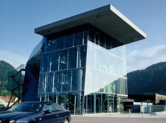
14 June 2002, 9.24: view from entry level towards the Mur river valley
14.6.2002 - 9:24, Eingangsniveau Blickrichtung Murau
© W. Feiersinger
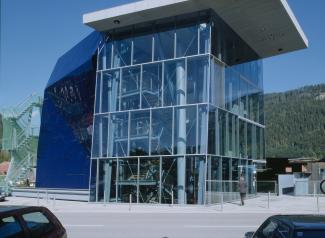
14 June 2002, 12.10: view from entry level towards the Mur river valley
14.6.2002 - 12:10, Eingangsniveau Blickrichtung Murau
© W. Feiersinger
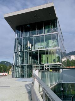
13 June 2003, 9.44: east side
13.6.2003 - 9:44, Ostseite
© W. Feiersinger
1/3

15 June 2002, 14.05: excavated, external void between the three structures, exterior view 1
15.6.2002 - 14:05, ausgegrabener, außenliegender Hohlraum zwischen den 3 Bauteilen, Blick 1
© w.feiersinger
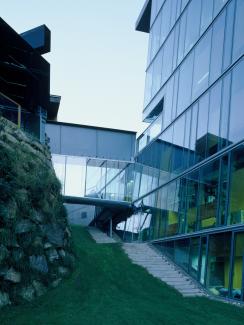
10 July 2002, 8.05: void between the 3 structures, exterior view 2
10.7.2002 - 08:05, Hohlraum zwischen den 3 Bauteilen, Blick 2
© W. Retter
1/3
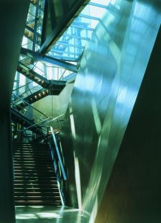
7 Apr. 2002, 7.45: underground, interior void, interior view 1
7.4.2002 - 7:45, unterirdischer, innenliegender Hohlraum, Blick 1
© W. Feiersinger
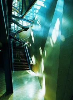
7 Apr. 2002, 7.53: underground, interior void, interior view 1a
7.4.2002 - 7:53, unterirdischer, innenliegender Hohlraum, Blick 1a
© W. Feiersinger
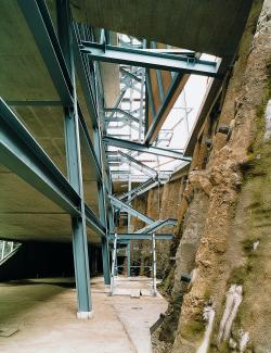
3 Oct. 2002, 13.27: underground, interior void, interior view 1c, shell with foundation pile wall permanently anchored in the ground at 3 levels
3.10.2000 - 13:27, unterirdischer, innenliegender Hohlraum, Blick 1c, Rohbau mit aufgelöster permanent auf 3 Horizonten erdverankerter Bohrpfahlwand
© Veronika Hofinger
1/3
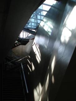
10 Mar. 2003, 6.20: underground, interior void, interior view 2
10.3.2003 - 6:20, unterirdischer, innenliegender Hohlraum, Blick 2
© W. Feiersinger
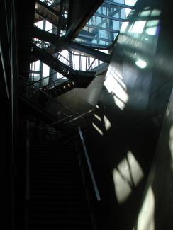
10 Mar. 2003, 6.27: underground, interior void, interior view 3
10.3.2003 - 6:27, unterirdischer, innenliegender Hohlraum, Blick 3
© W. Feiersinger
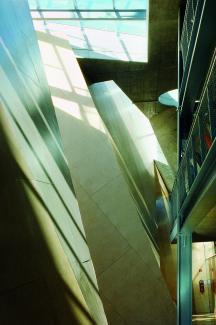
23 Mar. 2003, 9.45: underground, interior void, interior view 5
23.3.2003 - 9:45, unterirdischer, innenliegender Hohlraum, Blick 5
© W. Feiersinger
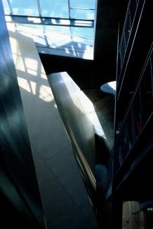
10 Mar. 2004, 10.15: underground, interior void, interior view 5
10.3.2004 - 10:15, unterirdischer, innenliegender Hohlraum, Blick 5
© W. Feiersinger
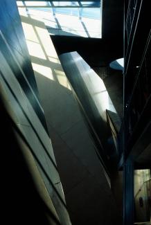
10 Mar. 2004, 9.33: underground, interior void, interior view 5
10.3.2004 - 9:33, unterirdischer, innenliegender Hohlraum, Blick 5
© W. Feiersinger
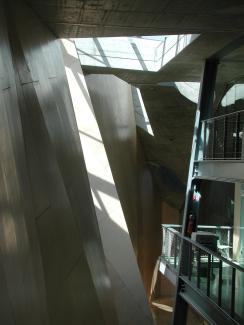
10 Mar. 2004, 11.52: underground, interior void, interior view 5
10.3.2004 - 11:52, unterirdischer, innenliegender Hohlraum, Blick 5
© TWA
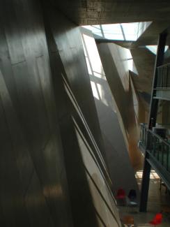
10 Mar. 2004, 12.37: underground, interior void, interior view 5
10.3.2004 - 12:37, unterirdischer, innenliegender Hohlraum, Blick 5
© TWA
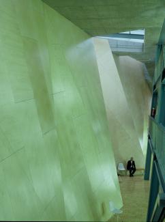
13 Dec. 2004, 12.20: underground, interior void, interior view 5
13.12.2004 - 12:20, unterirdischer, innenliegender Hohlraum, Blick 5
© TWA
1/8
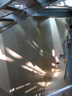
Underground, interior void, interior view 5a
Unterirdischer, innenliegender Hohlraum, Blick 5a
© TWA
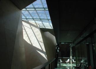
Underground, interior void, interior view 6, minus 4.7m on 7 Apr. 2002 at 14:39
Unterirdischer, innnenliegender Hohlraum, Blick 6,
minus 4,7m am 7.4.2002 um 14:39
© TWA
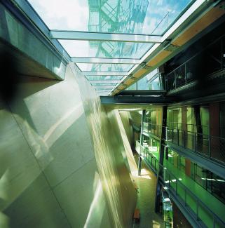
Underground, interior void, interior view 4
Unterirdischer, innnenliegender Hohlraum, Blick 4
© W. Retter
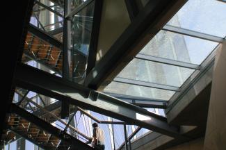
Skylights at street level 1
Oberlichten auf Strasseniveau 1
© TWA
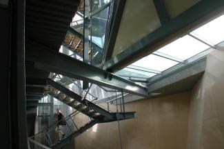
Skylights at street level 2
Oberlichten auf Strasseniveau 2
© TWA
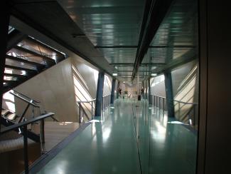
Circulation areas approx. 3.5m below ground level
Erschließungsbereiche ca. 3,5m unter Niveau
© W. Feiersinger
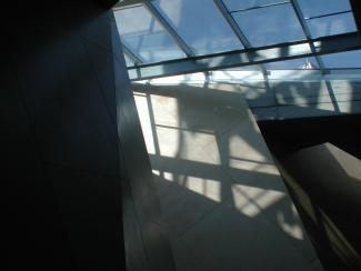
Underground, interior void, minus 4.7m on 7 Apr. 2002 at 12:53
Unterirdischer, innnenliegender Hohlraum,
minus 4,7m am 7.4.2002 um 12:53
© W. Feiersinger
1/8
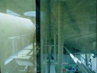
Public health office, 6.3m below ground level
12 July 2002, 12.12
Büros des Amtsarztes, 6,3 m unter Niveau
12.7.2002, 12:12
© W. Feiersinger
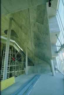
Public health office, under construction
Büros des Amtsarztes, Bauzustand
© W. Feiersinger
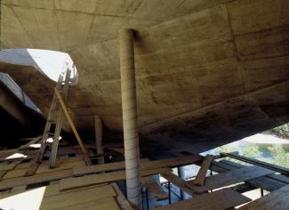
Public health office, under construction
Büros des Amtsarztes, Bauzustand
© W. Feiersinger
1/3
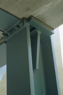
Junction type 1, steel construction in concrete slab
Knotentyp 1, Stahlbau in Betonplatte
© W. Feiersinger
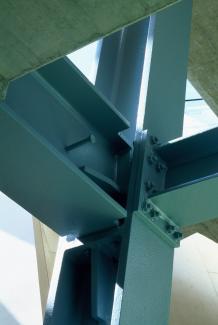
Exposed steel construction junction 1
Freigelegter Stahlbauknoten 1
© W. Feiersinger
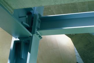
Exposed steel construction junction 2
Freigelegter Stahlbauknoten 2
© W. Feiersinger
1/3
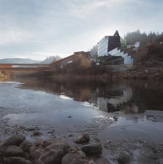
Mur river, during construction
View from -13.30m on 5 Nov. 2001, 8.00
Flussraum der Mur, Bauzustand
Blick von minus 13,30m am 5.11.2001, 8:00
© Wolfgang Retter
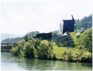
Mur river
Flussraum der Mur
© Veronika Hofinger
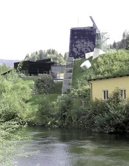
Mur river, view from -12,6m on 7 Aug. 2003, 13:40
W. Feiersinger
Flussraum der Mur, Blick von -12,6m am 7.8.2003 um 13:40
W. Feiersinger
© TWA
1/3
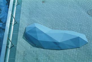
Werner Feiersinger, sculpture, untitled
Werner Feiersinger, Skulptur, o.T.
© Walter Pamminger
1/1
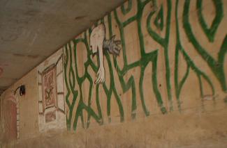
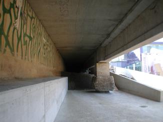
bypass road branching off the state road B96
bypass road branching off the state road B96
© TWA
1/2
Plans
22/2

Horizontal section of the Mur river banks as existing
Horizontalschnitt durch das vorgefundene Ufer der Mur
© Pamminger, Schmidt
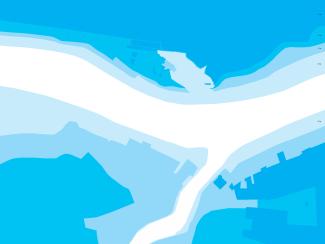
Horizontal section of the Mur river bans with excavated void
Horizontalschnitt durch die Ufer der Mur mit ausgegrabenen Hohlraum.
© Pamminger, Schmidt
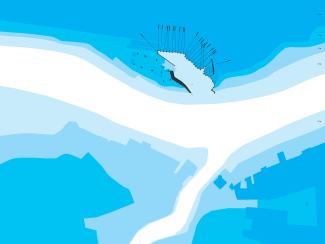
Horizontal section of the Mur river bans with excavated void reinforced by retaining structures
Horizontalschnitt durch die Ufer der Mur mit dem durch Hangstützmassnahmen gefestigten Hohlraum.
© Pamminger, Schmidt
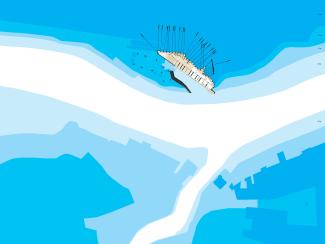
Horizontal section of the Mur river banks with excavated void, retaining structures and space allocation plan positioned at level 1
Horizontalschnitt durch Murufer mit Hohlraum, Hangstützmassnahmen und positioniertem Raumprogramm auf Ebene 1.
© Pamminger, Schmidt
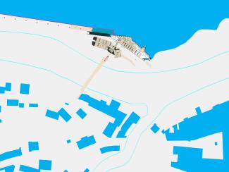
Horizontal section of the Mur river banks. The building is unobstructed on the river side and set into the hill on the road side.
Horizontalschnitt durch Murufer. Das Gebäude liegt zum Fluss hin frei, zur Strasse hin im Uferhang.
© Pamminger, Schmidt
1/5
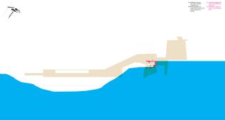
Cross section,
existing structures marked in magenta
Querschnitt,
Magenta markiert Bestandsbauteile.
© Pamminger, Schmidt
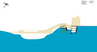
Cross section,
existing structures marked in magenta
Querschnitt,
Magenta markiert Bestandsbauteile.
© Pamminger, Schmidt
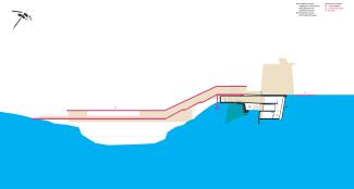
Cross section,
existing structures marked in magenta: Mursteg footbridge by Meili/Peter/Conzett
Querschnitt,
Magenta markiert Bestandsbauteile: Mursteg von Meili / Peter / Conzett erstellt.
© Pamminger, Schmidt
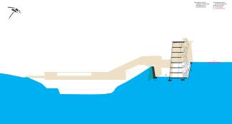
Cross section
Querschnitt
© Pamminger, Schmidt
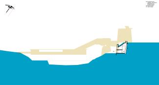
Cross section
Querschnitt
© Pamminger, Schmidt
1/5
Videos
11/1
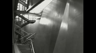
Bezirkshauptmannschaft Murau
(Bürogebäude der öffentlichen Verwaltung)
Videos
MURAU Donnerstag 12.08.2004
20:37 bis Samstag 14.08.2004,
13:27, Aufnahme: 12 Rahmen im Intervall von 30 Sekunden
© zone.co.at
1/1
Click & drag to move images
Scroll to zoom images